Research
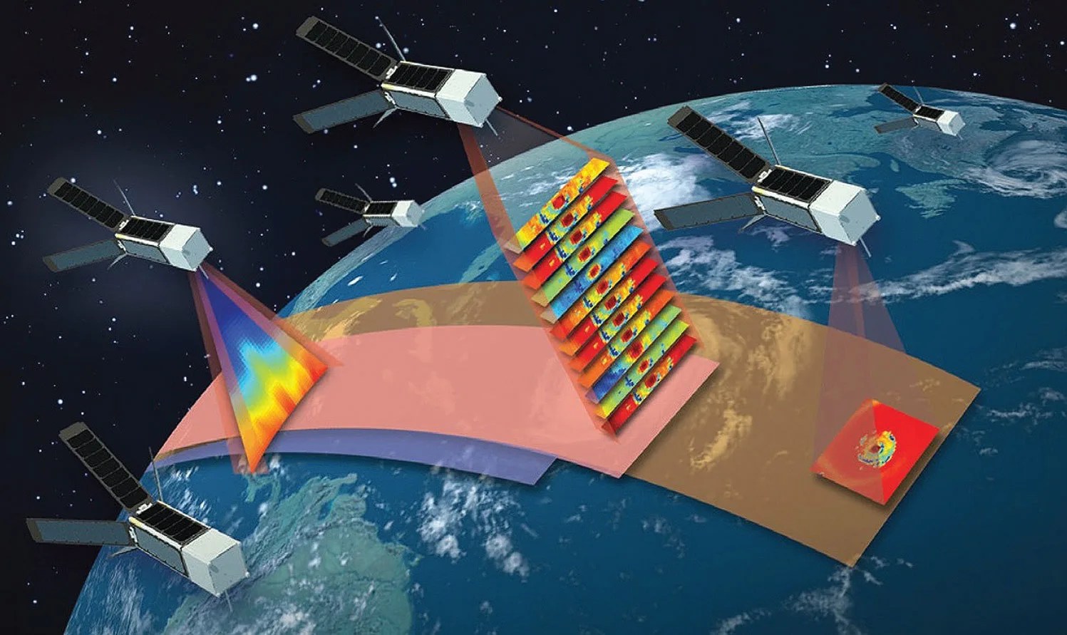
The Weather and Atmospheric Dynamics focus area supports research to obtain accurate measurements of the atmosphere that help improve short-term, subseasonal, and seasonal weather predictivity and predictions at local, regional, and global scales.
Focus Area News

NASA, SpaceX Launch NOAA’s Latest Weather Satellite

Coordination Between NASA HQ and the National Hurricane Center
Focus Area Overview
The Weather and Atmospheric Dynamics focus area supports research to obtain accurate measurements of the atmosphere that help improve short-term, subseasonal, and seasonal weather predictions at local, regional, and global scales. Weather includes everything from localized microphysical processes that occur in minutes, to global-scale phenomena that can occur for an entire season.
Weather and Atmospheric Dynamics helps improve our knowledge of the fundamental processes that drive these systems and inform the operational infrastructure upon which other federal agencies rely, including the National Oceanic and Atmospheric Administration (NOAA), the Federal Aviation Administration (FAA), and the Department of Defense (DOD). Weather and Atmospheric Dynamics further supports research into profiling winds, temperature, humidity, pressure, and aerosols; air-sea and land-atmosphere interactions; and lightning occurrences.
Guiding and Planning Documents
The Questions That Drive NASA's Weather and Atmospheric Dynamics Research
How can sub-seasonal to seasonal weather forecast duration and reliability be improved?
How can we improve predictive capability for weather, including extreme events?
What is the role of deep convective towers and precipitation on a tropical storm’s life cycle?
To what extent are storm intensification processes predictable?
How can we use NASA, NOAA, and other countries’ satellite observations innovatively and transition new algorithms, data, and tools to weather forecast operations at our partner agencies?

Funded Research Opportunities
Solicited program elements relevant to Weather and Atmospheric Dynamics are publicized through the Research Opportunities in Space and Earth Sciences (ROSES) NASA Research Announcements (NRAs) on the NASA Solicitation and Proposal Integrated Review and Evaluation System (NSPIRES) website. Past, open, and future solicitations can be searched and viewed on NSPIRES.
- A.24 Weather and Atmospheric Dynamics: Due November 8, 2024
- A.32 Precipitation Measurements Mission and CloudSat and Calipso Science Team Recompete: Due November 20, 2024
- A.48 Commercial Satellite Data Earth Science Research and Applications: Step-1 Due January 31, 2025, Step-2 Due March 26, 2025
- A.55 Decadal Survey Incubation Program: Science and Technology: Due December 17, 2024
- A.61 INjected Smoke and PYRocumulonimbus Experiment Science Team: Due January 24, 2025
- F.5 Future Investigators in NASA Earth and Space Science and Technology: Due February 5, 2025
Research Programs
 The DC-8 aircraft engines are visible through the passenger window. Each day, the team took off from Cabo Verde, an island nation in the east tropical North Atlantic Ocean, logging roughly 100 hours altogether.NASA/Amin Nehrir
Weather and Atmospheric Dynamics
Weather and Atmospheric Dynamics studies the dynamics of the atmosphere, temperature, moisture, and wind to better understand the conditions that drive specific weather events. This research improves computer models, algorithms, and data assimilation that support short-term to seasonal weather prediction and understanding. To do this, the Weather program observes atmospheric phenomena associated with the water cycle through suborbital and satellite observations to determine the relationship between atmospheric thermodynamics, dynamics, storm structure, and convection; ocean surface properties; and radiation within weather systems. Ultimately, Weather and Atmospheric Dynamics hopes to improve process models in these areas, provide initial conditions and assimilation of data to better characterize and understand weather systems, and develop long-term time-series of atmospheric analyses to support weather and climate studies.
 The ten satellites in the Global Precipitation Measurement Constellation provide unprecedented information about the rain and snow across the entire Earth.NASA’s Scientific Visualization Studio
Precipitation Science
The NASA Precipitation Measurement Missions (PMM) Science Team conducts scientific research including algorithm development, mission implementation, product validation, and data utilization in support of the Global Precipitation Measurement (GPM) and Tropical Rainfall Measuring Mission (TRMM) satellites. Research topics include storm structure and mesoscale dynamics, the global water cycle, climate analysis, and precipitation microphysics. In addition, Precipitation Science programs support work on precipitation algorithms, ground validation studies, and applications.
 Lightning events detected by the LIS sensor on the ISS between January 2017 and July 2023 using a 10-day roving window. Data is from the quality controlled science dataset.NASA/Scientific Visualization Studio
Lightning
The primary objectives of the Lightning program include determining the relationship between the electrical characteristics of storms and precipitation, convection, and severe weather. Instruments have been designed, constructed, and deployed by NASA as ground-based, airborne, and space-based sensors capable of detecting and characterizing lightning in order to study the electrical behavior of thunderstorms.
 The Next-Generation Aerosol Wind Profiler (AWP) wind lidar is capable of providing near-simultaneous full 3-D wind vector retrievals. The AWP operates with laser pulse energy and has a repetition rate combination for high spatial and vertical resolution wind profiling from space.
Planetary Boundary Layer
Improved understanding and prediction accuracy of the atmospheric Planetary Boundary Layer (PBL) and the ability to make significant advances in several PBL application areas (e.g., air quality and human health, improved forecasting of severe storms, improved climate projections, renewable energies) are currently constrained by the lack of global PBL observations at sufficient spatial and temporal resolution and sampling. NASA works to identify the most critical PBL science and applications questions in the context of Earth System science considering the diverse spatial and temporal scales of the atmosphere, ocean, land, and ice. New observing technologies and approaches, including in situ as well as ground-based, airborne, and satellite remote sensing, have the potential to significantly increase the quality, amount, and types of observations collected within the PBL.
 Example of global weather observations assimilated into the NASA Goddard Earth Observing System (GEOS)-5 data assimilation system. Data assimilation occurs multiple times per day.NASA SVS
Satellite Data Assimilation
The Global Modeling and Assimilation Office (GMAO) uses comprehensive global models and data assimilation techniques to maximize the impact of satellite observations in climate, weather, and atmospheric composition prediction. To achieve this goal, GMAO develops models and assimilation systems for the atmosphere, ocean, and land surface; generates products to support NASA instrument teams for field campaigns and the NASA Earth Science Research and Analysis program; and undertakes scientific research to inform modeling system development. The Joint Center for Satellite Data Assimilation (JCSDA) is a partnership among NASA, NOAA, and DoD. Its mission is to accelerate and improve the quantitative use of research and operational satellite data in weather, ocean, and environmental analysis and prediction models.
 The Modern Era Retrospective-analysis for Research and Applications (MERRA) was developed to support NASA's Earth science objectives, by applying the state-of-the-art GMAO data assimilation system that includes many observing systems in a climate framework.NASA/ Scientific Visualization Studio
High-End Computing and Modeling
The NASA High-End Computing Program supports the agency's aeronautics research, human exploration, scientific discovery, and space operations missions. Our programs support Earth Science computational modeling needs, primarily focusing on weather and climate models. ThHigh-End Computing Program also supports the development of machine learning and artificial intelligence foundation models, among other numerical techniques to study global climate change, weather forecasting, and prediction problems.
 Geostationary satellite view of clouds and weather systems over the Western Hemisphere. The GeoColor imagery combines data from multiple satellite channels to approximate what the human eye would see from space.NASA SVS
Operational Geostationary Satellite Systems
Earth Science Research from Operational Geostationary Satellite Systems is a cross-cutting Earth Science Division program element managed by the Weather and Atmospheric Dynamics Focus Area. The program provides an opportunity for the Earth Science research community to perform scientific research using data from the new generation of operational geostationary satellites. Program achievements include advancing the understanding of changes in the Earth’s radiation balance, air quality, and ozone layer, improving the capability to predict weather and extreme weather events, and enabling better assessment of the global water cycle, among other goals that inform decisions and provide benefits to society.
 The NASA Short-term Prediction Research and Transition (SPoRT) Center at Marshall Space Flight Center developed DustTracker-AI, a physically-based machine learning model to track dust into the night-time hours.
Short-term Prediction Research and Transition
The Short-term Prediction Research and Transition Center (SPoRT) takes the data products and algorithms from NASA research satellites and transitions them to NOAA’s National Weather Service (NWS) Weather Forecast Offices (WFOs). SPoRT aims to improve short-term forecasts on a regional scale.
Distributed Active Archive Centers (DAACs)
Missions and Campaigns
The Weather and Atmospheric Dynamics team manages and utilizes data from many Earth observing missions and campaigns. We've cataloged them all on this page and sorted them by type and mission phase.
Learn More
Public Events
Upcoming Meetings & Workshops
- 105th American Meteorological Society (AMS) Annual Meeting, 12-16 January 2025, New Orleans, LA, USA.
- CYGNSS Science Team Meeting, 3-5 February 2025, Miami, FL, USA.
- Decadal Survey Planetary Boundary Layer Incubation Community Meeting, 1-3 April 2025, Washington, DC, USA.
Past Meetings & Workshops
Session materials and recordings linked as available.
- American Geophysical Union 2024 Fall Meeting, 9-13 December 2024, Washington, DC, USA.
- INCUS Science Team Meeting, 13-15 November 2024, Fort Collins, CO, USA.
- AIRS Science Team Meeting, 24-27 September 2024, Pasadena, CA, USA.
- PMM Science Team Meeting, 9-11 September 2024, San Diego, CA, USA.
- IMPACTS 2024 Science Team Meeting, 30-31 July 2024
- CYGNSS Science Team Meeting, 14-16 May 2024, Ann Arbor, MI, USA.
- TROPICS Science Team Meeting, 9 May 2024, Long Beach, CA, USA.
- AMS 36th Conference on Hurricanes and Tropical Meteorology, 6-10 May 2024, Long Beach, CA, USA.
- Decadal Survey Planetary Boundary Layer Incubation Community Meeting, 23-24 April 2024, Pasadena, CA, USA.
- GPM 10th Anniversary Event, 27 February 2024, Greenbelt, MD, USA.
- 104th American Meteorological Society (AMS) Annual Meeting, 28 January - 2 February 2024, Baltimore, MD, USA.
Collaborating Organizations
NASA Center Programs
- Ames Earth Science Division
- Applied Sciences SERVIR Global Program
- Global Modeling and Assimilation Office
- Goddard Space Flight Center Earth Sciences
- Jet Propulsion Laboratory Earth Sciences
- Land Information System
- Langley Science Directorate
- Marshall Earth Science Office
- Precipitation Measurement Missions Science Team
- Short-term Prediction Research and Transition Center
Interagency and International Partnerships
Contacts
In memoriam, Gail Skofronick-Jackson (Bio)


