All Mars Resources

Filters

A woman wearing glasses works at a computer in mission control.

Mars Report: Earth to Mars: How NASA Keeps Curiosity Connected

See why Curiosity’s location in Gediz Vallis channel makes it difficult to send direct commands — and how the team…

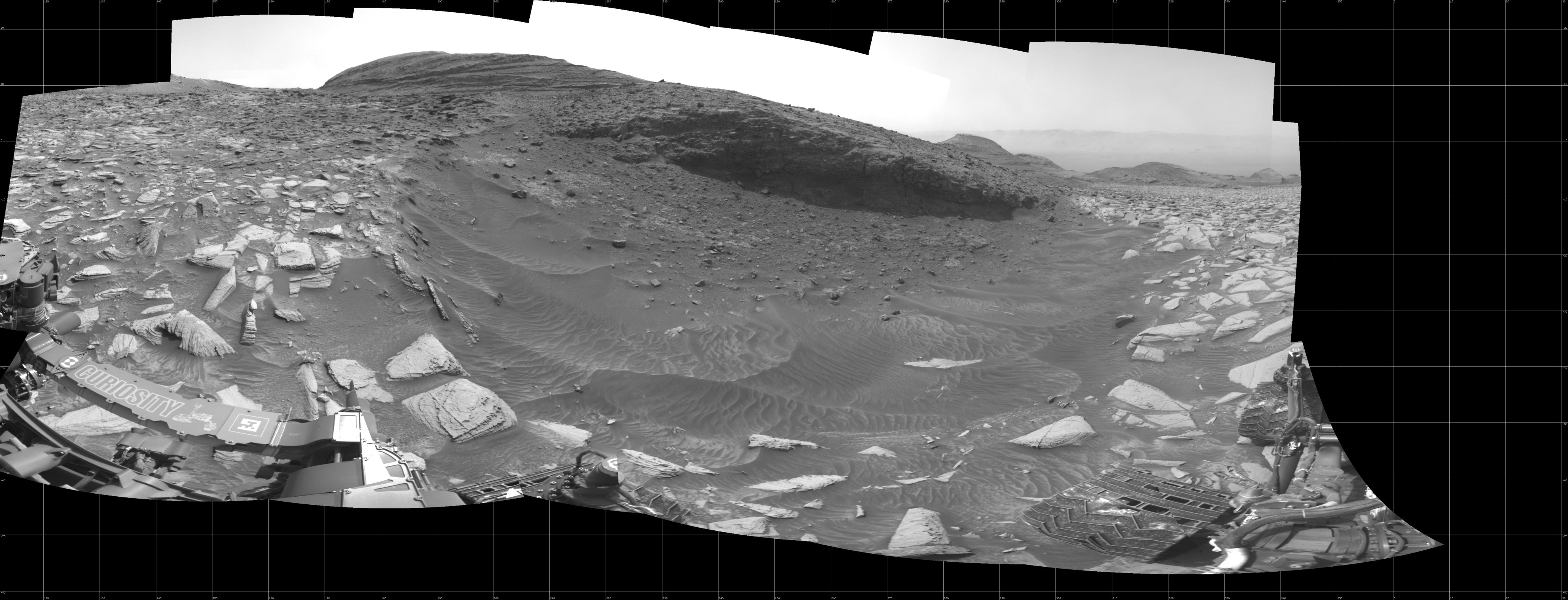
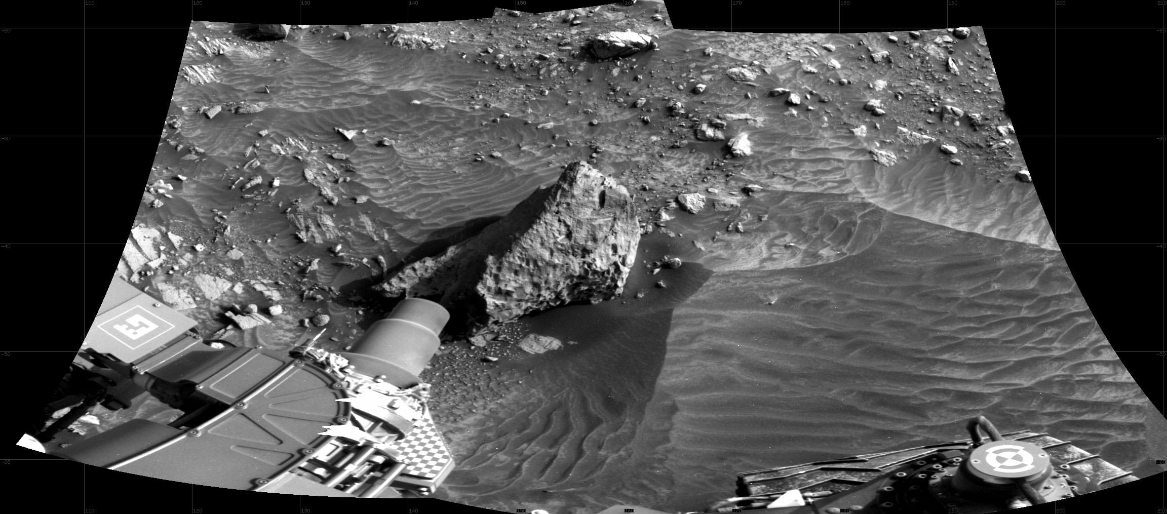
A grayscale panoramic image of the Martian surface shows booth sky and ground well-lit. The rolling terrain is marked by uneven slabs of rock covered in some areas by soil and small rocks. In the background, a wide, gently sloping, layered rock hill rises above the ground at center. Farther away, to the right, is another hill with a more pointed top, and at third rises up to the right edge of the frame. Portions of the Curiosity rover are visible in the frame of this extreme wide-angle image, taking up most of the lower-left corner. Several instruments and pieces of equipment are visible atop the rover, as are logos for NASA and JPL, with very dark, fine dust covering some areas.

Sol 4294: Right Navigation Camera, Cylindrical Projection

Curiosity took the images on September 04, 2024, Sol 4294 of the Mars Science Laboratory mission at drive 1480, site…

A grayscale panoramic image of the Martian surface shows booth sky and ground well-lit. The rolling terrain is marked by uneven slabs of rock covered in some areas by soil and small rocks. In the background, a wide, gently sloping, layered rock hill rises above the ground at center. Farther away, to the right, is another hill with a more pointed top, and at third rises up to the right edge of the frame. Portions of the Curiosity rover are visible in the frame of this extreme wide-angle image, taking up most of the lower-left corner. Several instruments and pieces of equipment are visible atop the rover, as are logos for NASA and JPL, with very dark, fine dust covering some areas.

Sol 4293: Right Navigation Camera, Cylindrical Projection

Curiosity took the images on September 03, 2024, Sol 4293 of the Mars Science Laboratory mission at drive 1468, site…

A grayscale panoramic image of the Martian surface shows darkening skies and ground, where the rolling terrain is marked by uneven slabs of rock covered in some areas by soil and small rocks. In the background, a gently sloped, layered rock hill rises above the ground at top right. To the left is a larger hill rising from the ground. The hill on the right is hiding the Sun, which is illuminating the only bright area in the picture, the sky above and to the sides of the hill. Portions of the Curiosity rover are visible at the left, right, and bottom edges of the extreme wide-angle image.

Sol 4289: Right Navigation Camera, Cylindrical Projection

Curiosity took the images on August 30, 2024, Sol 4289 of the Mars Science Laboratory mission at drive 1384, site…

A grayscale panoramic image of the Martian surface shows darkening skies and ground, where the rolling terrain is marked by uneven slabs of rock covered in some areas by soil and small rocks. A gently sloped, layered rock hill dominates the background in the top center of the image, hiding the Sun, which is illuminating the only bright area in the picture, the sky above and to the sides of the hill. Portions of the Curiosity rover are visible at the left, right, and bottom edges of the extreme wide-angle image.

Sol 4287: Right Navigation Camera, Cylindrical Projection

Curiosity took the images on August 28, 2024, Sol 4287 of the Mars Science Laboratory mission at drive 1134, site…

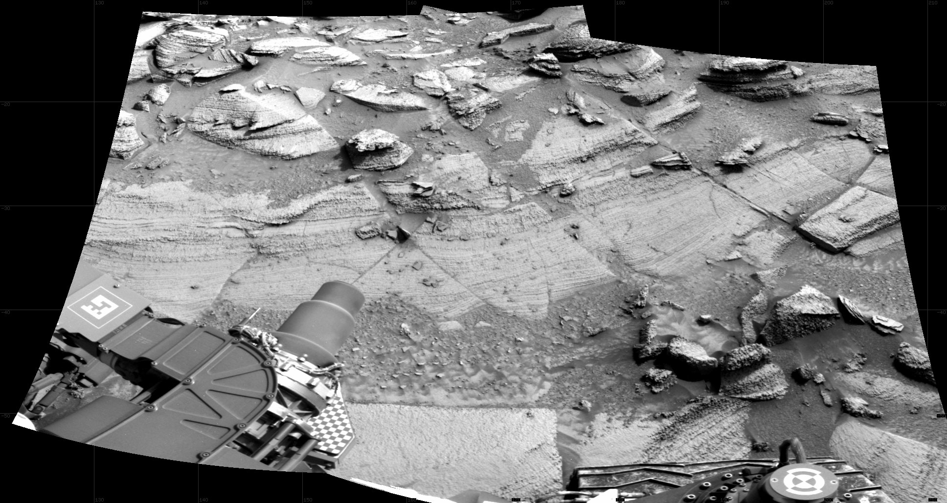
A grayscale panoramic image of the Martian surface shows darkening skies and ground, where the terrain is marked by uneven slabs of rock covered in some areas by soil and small rocks. A gently sloped, layered rock hill dominates the background in the top center of the image, hiding the Sun, which is illuminating the only bright area in the picture, the sky above and to the sides of the hill. Portions of the Curiosity rover are visible at the left, right, and bottom edges of the extreme wide-angle image.

Sol 4282: Right Navigation Camera, Cylindrical Projection

Curiosity took the images on August 23, 2024, Sol 4282 of the Mars Science Laboratory mission at drive 876, site…

This poster shows a blue-orange gradient background overlayed with a path of all 72 ngenuity's flights.

Ingenuity 72 Pathbreaking Flights (Poster)

The Ingenuity Mars Helicopter made history on August 19, 2021, when it completed the first powered, controlled flight on another…

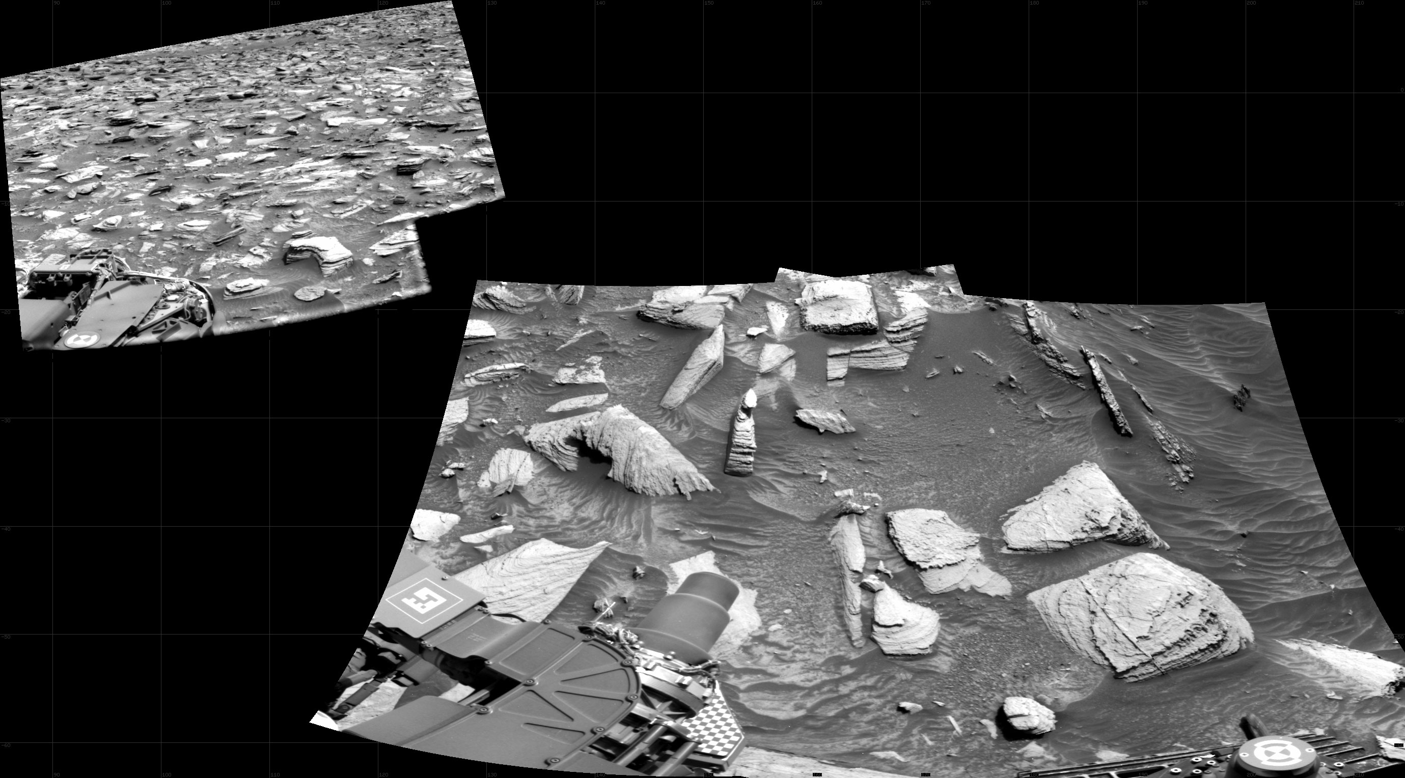
A grayscale photo panorama of the Martian surface shows an area of flat ground in the foreground, with some smooth and some rocky sections interspersed, and two tall buttes in the background, one at the right side of the image and one dominating the center. The center one is brightly backlit by glowing sunlight. Portions of the Curiosity rover are visible at the far left, bottom, and far right of the frame.

Sol 4263: Right Navigation Camera, Cylindrical Projection

Curiosity took the images on August 03, 2024, Sols 4263-4255 of the Mars Science Laboratory mission at drive 792, site…

A grayscale photo panorama of the Martian surface shows an area of flat ground in the foreground, with some smooth and some rocky sections interspersed, and two tall buttes in the background, one at the right side of the image and one dominating the center. The center one is brightly backlit by glowing sunlight. Portions of the Curiosity rover are visible at the far left, bottom, and far right of the frame.

Sol 4261: Right Navigation Camera, Cylindrical Projection

Curiosity took the images on August 01, 2024, Sols 4261-4255 of the Mars Science Laboratory mission at drive 792, site…

This map shows the route NASA’s Perseverance Mars rover will take (in blue) as it climbs the western rim of Jezero Crater, first reaching “Dox Castle,” then investigating the “Pico Turquino” area before approaching “Witch Hazel Hill.”

Perseverance’s Climb to ‘Witch Hazel Hill’

This map shows the route NASA’s Perseverance Mars rover will take (in blue) as it climbs the western rim of…

This panorama shows the area NASA’s Perseverance Mars rover will climb in coming months to crest Jezero Crater’s rim. It is made up of 59 images taken by the rover’s Mastcam-Z on Aug. 4.

Perseverance Rover’s View Up Crater

This panorama shows the area NASA’s Perseverance Mars rover will climb in coming months to crest Jezero Crater’s rim. It…

One of the navigation cameras aboard NASA’s Perseverance Mars rover captured this view looking back at the “Bright Angel” area on July 30, the 1,224th Martian day, or sol, of the mission.

Perseverance Looks Back at ‘Bright Angel’

One of the navigation cameras aboard NASA’s Perseverance Mars rover captured this view looking back at the “Bright Angel” area…

NASA program scientist Lindsay Hays explains what defines potential signs of ancient life on other worlds and why they require future study. NASA’s Perseverance Mars rover is searching for these signs, collecting samples for future return to Earth, and helping pave the way for human exploration.

What is a Potential Biosignature?

NASA program scientist Lindsay Hays explains what defines potential signs of ancient life on other worlds and why they require…

A man wearing a medical face mask stands at a podium giving a speech.

Intriguing Mars Rock: Perseverance Project Scientist’s Conference Talk on Mars Sample Return

A key objective of Perseverance rover’s mission on Mars is astrobiology, including caching samples that may contain signs of ancient…

A retro handpainted illustration of a Viking lander extending its robotic arm on the surface of Mars.

Viking Mission to Mars—Animation and Footage

Retro-style video features animation of one of NASA's Viking spacecraft en route to Mars and landing there in the mid-1970s.…