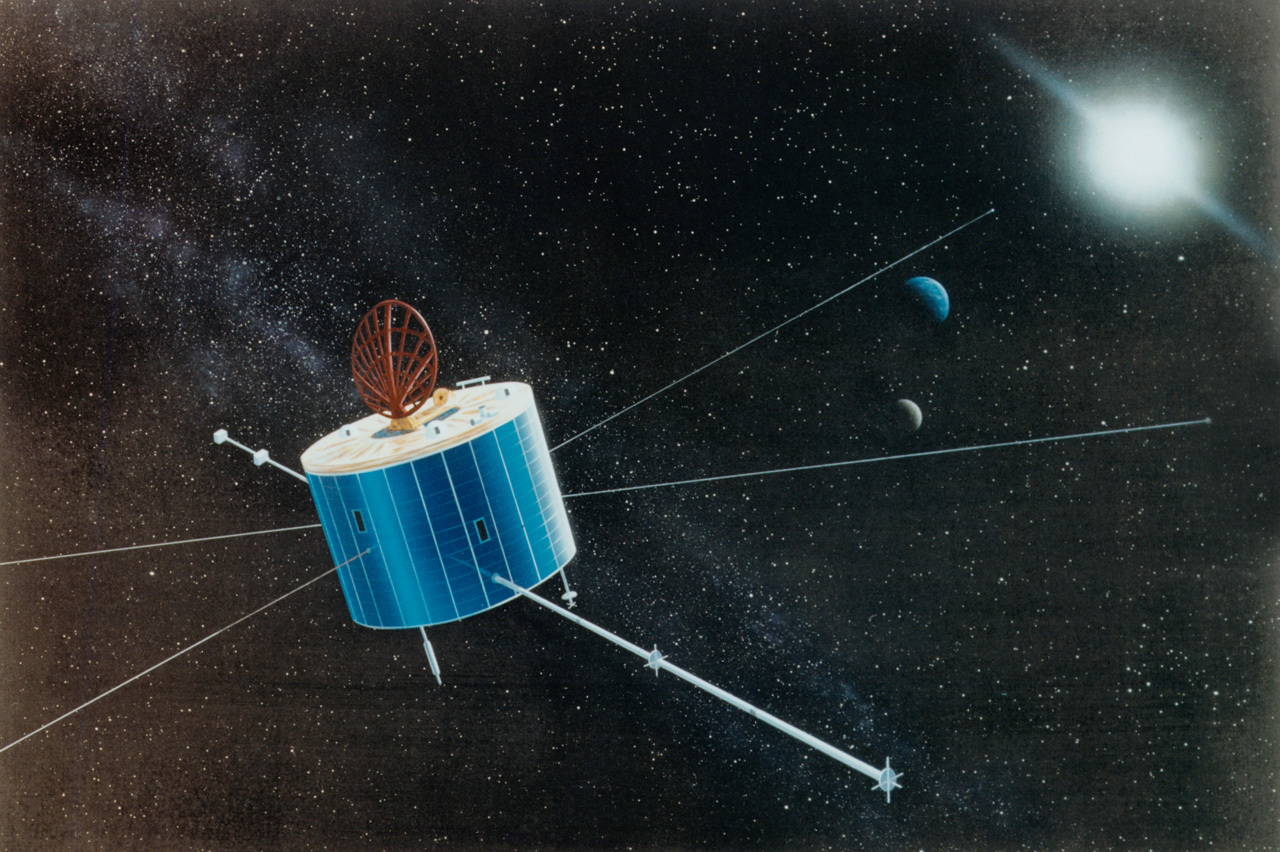
Geotail
Type
Launch
Target
Objective
Geotail provided information about the way the magnetic envelope surrounding Earth, called the magnetosphere, responds to incoming material and energy from the Sun.

What was Geotail?
Geotail provided information about the way the magnetic envelope surrounding Earth, called the magnetosphere, responds to incoming material and energy from the Sun.
- Surviving more than much longer than planned, Geotail continued to send back crucial data until operations ended on Nov. 28, 2022.
Nation(s) | Japan and the United States of America (USA) |
Objective(s) | High Elliptical Earth Orbit |
Spacecraft | Geotail |
Spacecraft Mass | 2,225 pounds (1,009 kilograms) |
Mission Design and Management | Institute of Space and Astronautical Science / NASA |
Launch Vehicle | Delta 6925 (no. D212) |
Launch Date and Time | July 24, 1992 / 14:26 UT |
Launch Site | Cape Canaveral Fla. / Launch Complex 17A |
Scientific Instruments | 1. Magnetic Fields Measurement Monitor (MGF) 2. Low Energy Particles Experiment (LEP) 3. Electric field monitor (EFD) 4. Energetic Particles and Ion Composition Experiment (EPIC) 5. High-Energy Particle Monitors (HEP) 6. Plasma Wave Instrument (PWI) 7. Comprehensive Plasma Instrument (CPI) |
Key Dates
July 24, 1992: Launch
July 2012: Geotail marked 20 years of continuous operation
Nov. 28, 2022: Mission operations ended
In Depth: Geotail
The Geotail mission was a joint project of Japan’s Institute of Space and Astronautical Science (ISAS) and later, from 2003, the Japan Aerospace Exploration Agency (JAXA) and NASA. The mission was part of the International Solar Terrestrial Physics (ISTP) project, which also included the Wind, Polar, SOHO, and Cluster missions.
Geotail’s goal was to study the structure and dynamics of the long tail region of Earth’s magnetosphere, which is created on the nightside of Earth by the solar wind. During active periods, the tail couples with the near-Earth magnetosphere, and often releases energy that is stored in the tail, activating auroras in the polar ionosphere.
NASA's Scientific Visualization Studio
Although technically not a deep space or planetary mission, Geotail, in its extremely elliptical orbit, performed numerous lunar flybys, some closer than the distance at which the Soviet Luna 3 took the first pictures of the far side of the Moon.
The spin-stabilized spacecraft (20 rpms) was designed with a pair of 328-foot (100-meter) tip-to-tip antennae and two 20-foot (6-meter)-long masts.
On its fifth orbit around Earth, near apogee, on Sept. 8, 1992, the spacecraft flew by the Moon at a range of about 7,900 miles (12,647 kilometers). The flyby raised apogee from 261,174 miles (426,756 kilometers) to about 540,000 miles (869,170 kilometers). The flybys continued almost every month and ultimately raised the spacecraft’s apogee to 870,000 miles (1.4 million kilometers). During these orbits, Geotail observed the magnetotail’s far region (from 80 to 220 times the radius of Earth or “Re”).
Geotail’s 14th and last flyby of the Moon occurred on Oct. 25, 1994, at a range of 14,000 miles (22,445 kilometers) and as a result, placed the spacecraft in orbits with progressively lower apogees. In November 1994, Geotail’s apogee was 50 Re, and by February 1995, it was down to 30 Re.
The lower orbit allowed the spacecraft to begin the second part of its mission, to study magnetotail substorms near Earth. During these orbits, perigee was about 10 Re, while the orbital inclination to the ecliptic plane was about –7 degrees in order that the apogee would be located in the magnetotail’s neutral plane during the winter solstice.
Later in the decade, Geotail’s orbit was adjusted so that it passed just inside Earth’s magnetosphere’s boundary plane on the dayside.
In 2012, the spacecraft celebrated 20 years of continuous operation.
On Nov. 28, 2022, after 30 years in orbit, mission operations for Geotail ended after the failure of the spacecraft’s remaining data recorder.
Key Source
Siddiqi, Asif A. Beyond Earth: A Chronicle of Deep Space Exploration, 1958-2016. NASA History Program Office, 2018.


