Mars Reconnaissance Orbiter
Science Instruments
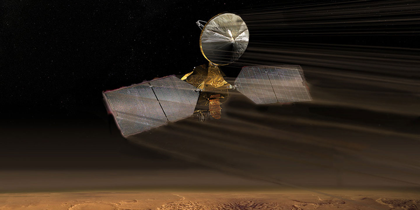
The Mars Reconnaissance Orbiter spacecraft carries six instruments, three engineering instruments, and two more science-facility experiments.
Cameras
High Resolution Imaging Experiment
The High Resolution Imaging Experiment is known as HiRISE. The big and powerful HIRISE camera takes pictures that cover vast areas of Martian terrain while being able to see features as small as a kitchen table. HiRISE has photographed hundreds of targeted swaths of Mars' surface in unprecedented detail.
The camera operates in visible wavelengths, the same as human eyes, but with a telescopic lens that produces images at resolutions never before seen in planetary exploration missions. These high-resolution images enable scientists to distinguish objects on Mars about 3 feet (1 meter) and to study the morphology (surface structure) in a much more comprehensive manner than ever before.
HiRISE also makes observations at near-infrared wavelengths to obtain information on the mineral groups present. From an altitude that varies from about 125 to 250 miles (200 to 400 kilometers) above Mars, HiRISE acquires surface images containing individual, basketball-size (1 to 2 feet, or 30 to 60 centimeters), pixel elements, allowing surface features 4 to 8 feet (about 1.3 to 2.4 meters) across to be resolved. These new, high-resolution images are providing unprecedented views of layered materials, gullies, channels, and other science targets, in addition to characterizing possible future landing sites.
Visit the Lunar and Planetary Laboratory at the University of Arizona instrument site:

Tech Specs
Main job | To study active surface processes and landscape evolution |
Location | On the nadir side of the spacecraft looking down at Mars |
Mass | ~143 pounds (65 kilograms), including thermal control system, cables, etc. |
Power | 60 watts |
Volume | ~5.2 feet (1.6 meters) long by ~2.9 feet (0.9 meter) diameter |
Data return | Can acquire images containing up to 28 gigabits of data in as little as 6 seconds |
Color quality | 14 electronic detectors, each covered by a filter in one of three wavelength bands: 400 to 600 nanometers (blue-green), 550 to 850 nanometers (red), or 800 to 1000 nanometers (near infrared), producing color images in the central portion of the field of view. |
Image size | Pixel size in images taken from an altitude of 186 miles (300 kilometers) is about 12 inches (30 centimeters) across (about basketball-size). Overall image size is a swath width of 3.7 miles (6 kilometers) by a programmable image length of up to 37 miles (60 kilometers). |
Image resolution | Smallest resolvable features in the images are about 3 feet (about 1 meter) across (features as small as a kitchen table in images covering swaths of Mars' surface 3.7 miles, or 6 km wide). |
Focal length | ~40 feet (12 meters) |
Focal ratio and field of view | f/24, yielding an IFOV of 1 x 1 μrad and a telescope FOV of 1.14 degrees x 0.18 degrees |
Context Camera
The Context Camera, called CTX, provides a big-picture, background view of the terrain around smaller rock and mineral targets that are studied by other cameras on Mars Reconnaissance Orbiter. CTX makes observations simultaneously with high-resolution images collected by HiRISE and data collected by the mineral-finding CRISM spectrometer.<br>CTX provides the wider context for the data collected by the other two instruments. Scientists examine details of rocks and mineral fields with the other instruments, while CTX provides a bigger-picture view of the terrain.
Visit the Malin Space: Science Systems instrument site.

Tech Specs
Main job | To help provide a context for high-resolution analysis of key spots on Mars provided by HiRISE and CRISM. |
Mass | 6.6 pounds (3 kilograms) |
Power | 7 watts (imaging); 5 watts (idling) |
Data return | Includes a 256 MB DRAM buffer, so that it can acquire pictures that have downtrack lengths greater than 99 miles (160 kilometers). |
Color quality | Black and white (grayscale); a broad band of visible light from 500 to 800 nanometers in wavelength. |
Image size | 5064 pixels-wide x varying length (due to a 256 MB DRAM buffer, so that it can acquire pictures that have downtrack lengths greater than 99 miles (160 kilometers). |
Image resolution | ~20 feet (6 meters) per pixel scale from an altitude of 186 miles (300 kilometers) over a swath 18.6 miles (30 kilometers) wide. |
Focal length | 13.7 inch (350 mm) focal length |
Focal ratio and field of view | f/3.25, IFOV of 0.001 degrees (20 μrad) and a FOV of 6 degrees |
Mars Color Imager
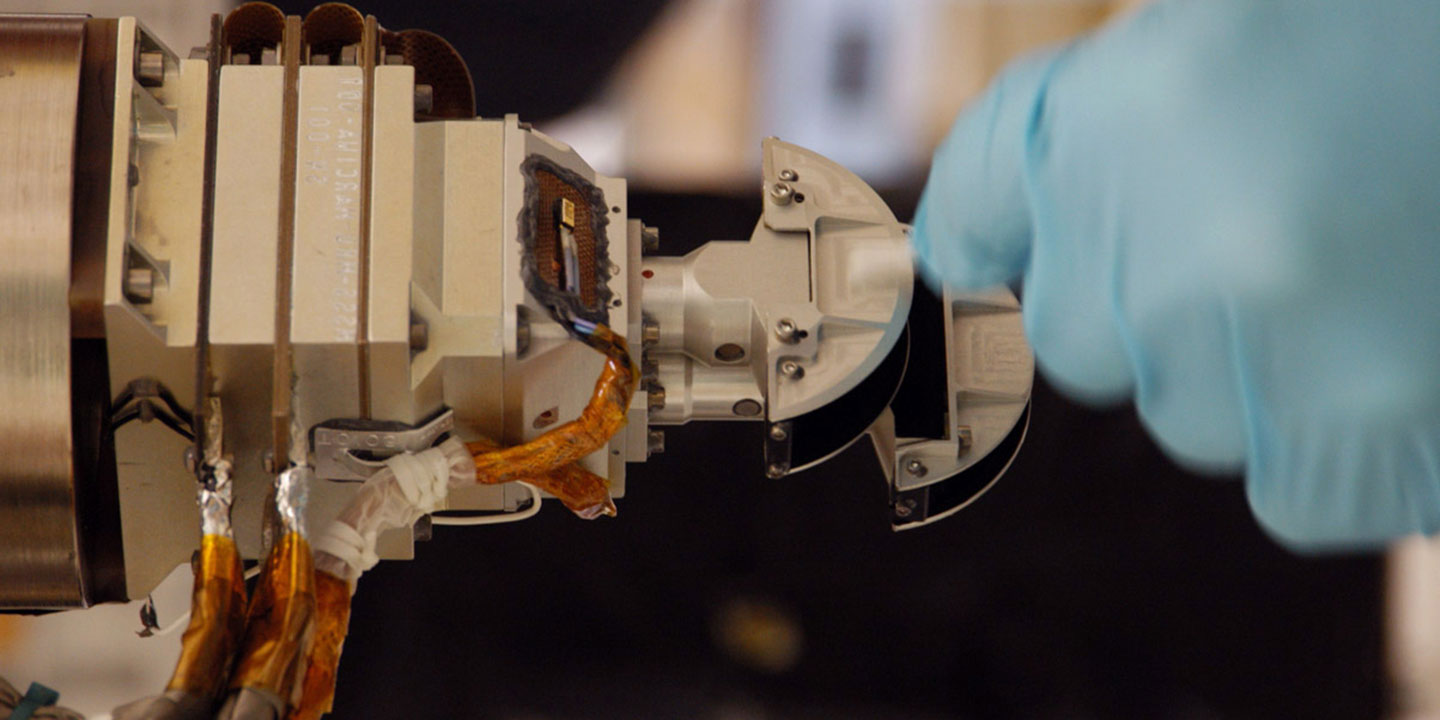
The Mars Color Imager, nicknamed MARCI, produces a global weather map of Mars that helps scientists understand the daily, seasonal, and year-to-year variations in the climate of the Red Planet.
MARCI also observes processes such as dust storms and changes in the polar cap using five visible bands. In addition, MARCI makes ultraviolet observations at two wavelengths to detect variations in ozone, dust, and carbon dioxide in the atmosphere. MARCI observes these processes on scales of tens of yards, or kilometers.
Visit the Malin Space Science Systems instrument site:
Tech Specs
Main job | To produce a global weather map of Mars to help characterize daily, seasonal, and year-to-year variations in the red planet's climate. |
Mass | ~1.06 pounds (481 grams) |
Power | <5 watts when imaging |
Size | 3.6 x 2.8 x 5.5 inches (9.2 x 7.2 x 14.0 centimeters) |
Data return | A full resolution seven-band, global image can be acquired and downlinked for about 6.2 Gbits/day. |
Color quality | Seven filters include five centered in visible-light wavelengths (425, 550, 600, 650 and 725 nanometers) and two in ultraviolet wavelengths (250 and 320 nanometers). |
Image size | 1000 pixels wide and can be many thousands of pixels long, depending on the objective of the image. |
Image resolution | Spatial resolution selectable from 0.6 mile (1 kilometer) per pixel to 6 miles (10 kilometers) per pixel. |
Focal length | Visible Optics 4.0 mm Ultraviolet Optics 3.8 mm at 260 nm, 4.0 mm at 317 nm |
Focal ratio and field of view | Visible Optics f/4.3, yielding an IFOV of 2.3 mrad and a FOV of 180 degrees crosstrack, 26 degrees downtrack Ultraviolet Optics f/7.5 at 260 nm; f/7.8 at 317 nm, yielding an IFOV of 2.3 mrad and a FOV of 180 degrees crosstrack, 26 degrees downtrack |
Spectrometer
Compact Reconnaissance Imaging Spectrometer
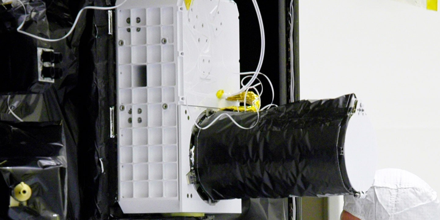
CRISM (Compact Reconnaissance Imaging Spectrometer for Mars) searches for the residue of minerals that form in the presence of water, perhaps in association with ancient hot springs, thermal vents, lakes, or ponds that may have existed on the surface of Mars.
Even though some landforms provide evidence that liquid water may have flowed on the surface of Mars long ago, evidence of mineral deposits created by long-term interaction between water and rock has been limited.
CRISM's visible and infrared spectrometers track regions on the dusty martian surface and map them at scales as small as 60 feet (18 meters) across, from an altitude of 186 miles (300 kilometers). CRISM reads the hundreds of "colors" in reflected sunlight to detect patterns that indicate certain minerals on the surface, including signature traces of past water.
The principal investigator (lead scientist) for CRISM is Scott Murchie from the Applied Physics Lab at Johns Hopkins University.
Visit the instrument site:
Tech Specs
Main job | To search for the residue of minerals that form in the presence of water. |
Location | Orbiter instrument deck |
Mass | ~72.5 pounds (32.92 kilograms) |
Power | 44.4 - 47.3 Watts during normal operations (~16 Watts during standby) |
Size | The main part of the instrument - the Optical Sensing Unit (OSU) - would fit in a box 30.4 x 22.3 x 15.4 inches (77.4 cm x 56.7 cm x 39.1 cm), including the baffle. |
Data return | Typical Full Resolution Targeted (FRT) observation is 2 - 2.5 Gigabits. |
Spectral resolution | Covers the spectral range from 362 - 3920 nm with a spectral sampling of 6.55 nm/channel. |
Swath width | About 5.8 to 7.4 miles (9.4 to 11.9 kilometers) |
Spatial sampling | 60.4 feet/ pixel from 185 miles altitude (18.4 meter/pixel at 300 kilometer altitude) |
Focal length | ~17.3 inches (441 millimeters) |
Focal ratio and field of view | f/4.41; IFOV of 61.5 μrad and a FOV of ~2.06 degrees |
Radiometer
Mars Climate Sounder
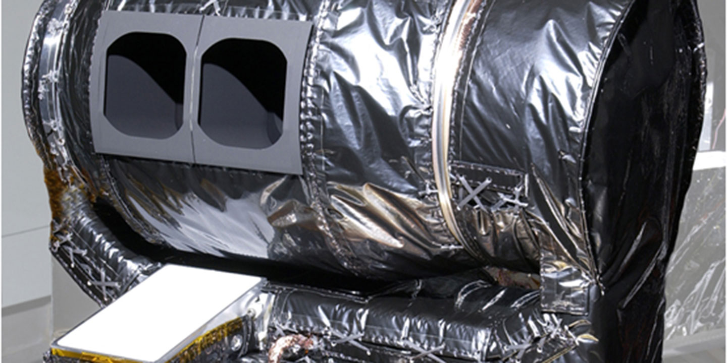
The Mars Climate Sounder (MCS) views the Martian atmosphere in visible and infrared light to measure the temperature, humidity, and dust content of the Martian atmosphere at 3-mile intervals (5 kilometers). The atmospheric profiles that are produced help scientists predict Martian weather and climate over time. The measurements also help explain how and why the Martian polar caps vary in response to the atmosphere and the energy input from the Sun.
How Mars Climate Sounder works
A sounder is an instrument that measures changes in atmospheric temperature or composition with height. Mars Climate Sounder "sees" in nine channels across the visible and infrared ranges of the electromagnetic spectrum. The visible range is the equivalent of what the human eye can see. The infrared range corresponds roughly to heat, being able to "see" how hot something is. One channel in the visible and near-infrared range (0.3-3.0 microns) is used to understand how solar energy interacts with the atmosphere and the surface, providing insight into Mars' climate. Eight channels in the thermal infrared range (12-50 microns) are used to measure temperature, pressure, water vapor, and dust.
Mars Climate Sounder looks at the horizon of Mars from orbit to observe the atmosphere in vertical slices. It takes measurements every 3 miles (5 kilometers) down into each slice through the atmosphere. These "profiles" are combined into daily, three-dimensional, global weather maps for both daytime and nighttime. The weather maps show temperature, pressure, humidity, and dust in various layers of the atmosphere -- the same kind of information meteorologists use to understand and predict weather and climate on Earth.
Tech Specs
Main job | To observe the temperature, humidity, and dust content of the Martian atmosphere, making measurements that show variations in Mars' current weather and climate. |
Mass | ~19.8 pounds (9 kilograms) |
Power | 11 Watts |
Data return | The MCS observation cycle consists of two-second signal integration intervals, interspersed every 34 seconds with instrument views of space. |
Spectral range and channels | 0.3 to 45.0 μm in nine spectral channels |
Focal ratio and field of view | f/1.7; Detector IFOV: 3.6 x 6.2 mrad 5.0 x 8.6 km (at limb); Instrument IFOV: 75 x 75 mrad 105 x 105 km (at limb) |
Radar
Shallow Radar
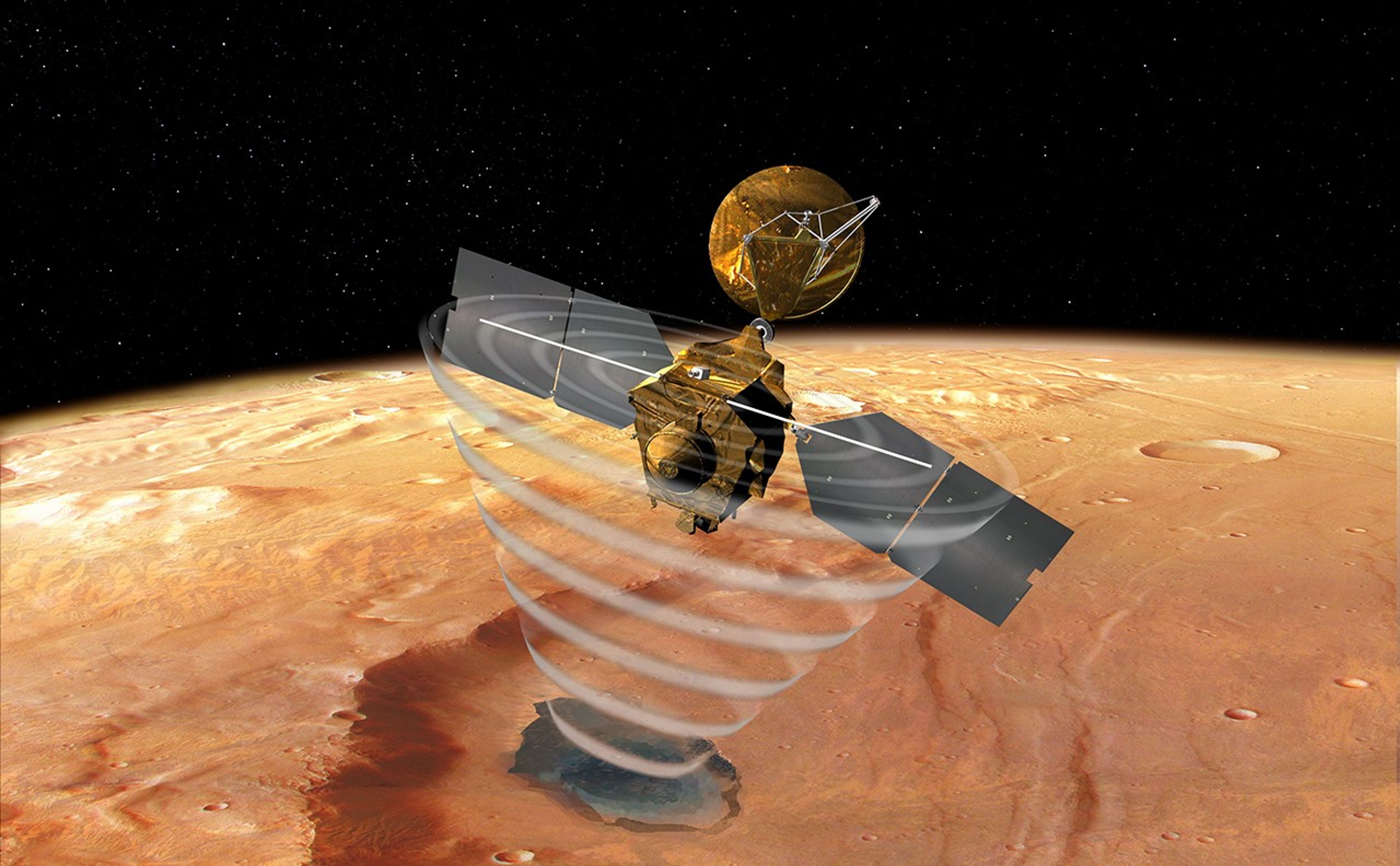
The Shallow Radar is also known as SHARAD. The radar "pings" the surface of Mars in search of a strong radar return wave that may indicate the presence of underground liquid or frozen in the first few hundreds of feet (up to 1 kilometer) of Mars' crust.
SHARAD probes the subsurface using radar waves within a 15- to 25-megahertz frequency band to get the desired, high-depth resolution.
The radar wave return, which is captured by the SHARAD antenna, is sensitive to changes in the electrical reflection characteristics of rock, sand, and any water that may be present in the surface and subsurface. Water, like high-density rock, is highly conducting, and has a very strong radar return. Changes in the reflection characteristics of the subsurface, caused by layers deposited by geological processes in the ancient history of Mars, are also visible.
Visit the instrument site:
Tech Specs
Main job | To look for liquid or frozen water in the first few hundreds of feet (up to 1 kilometer) of Mars' crust. |
Mass | 33 pounds (15 kilograms) |
Size | A SHARAD Electronics Box, and a ~33-foot (10-meter) antenna made up of two ~16-foot (5 meter) foldable tubes. |
Data return | The data volume for SHARAD is limited by the MRO allocation of 15% of its total data, which typically ranges from 40 to 90 Gb/day. |
Frequencies | Transmits "chirps" lasting 85-μsec (microseconds) each at radio frequency from 15 megahertz to 25 megahertz (wavelengths of about 50 feet, or 15 meters, in free space) with 10 watts of power. |
Resolution | Horizontal resolution of between ~0.2 and ~2 miles (between 0.3 and 3 kilometers) and a vertical resolution of about 50 feet (15 meters) in free space, which translates into better than 32 feet (10 meters) in the Martian subsurface. |
Engineering Instruments
Mars Reconnaissance Orbiter carries three instruments that assist with spacecraft navigation and communications.
The Electra telecommunication package provides (ELECTRA) navigation assistance to spacecraft when they are arriving at Mars. Electra also relays signals and data from landers and rovers when they don't have direct radio contact with Earth.
Toward the end of the primary science phase, other Mars missions launched in 2007 and beyond will begin to arrive. Mars Reconnaissance Orbiter will use its Electra UHF radio to support any navigation, command, and data-return needs these missions may have. If the arriving spacecraft has an Electra communications payload, it can receive these signals and use them to determine its distance and speed in relation to Mars. This communication allows much more precise navigation.
After incoming landers or rovers have arrived safely on Mars, Electra can provide precise Doppler data which, when combined with Mars Reconnaissance Orbiter's position information, can accurately determine the location of the lander or rover on the surface of Mars.
Electra can also provide UHF coverage to Mars landers and rovers on the surface that may not have sufficient radio power to communicate directly with Earth by themselves, using its nadir-pointed (pointed straight down at the surface) antenna.
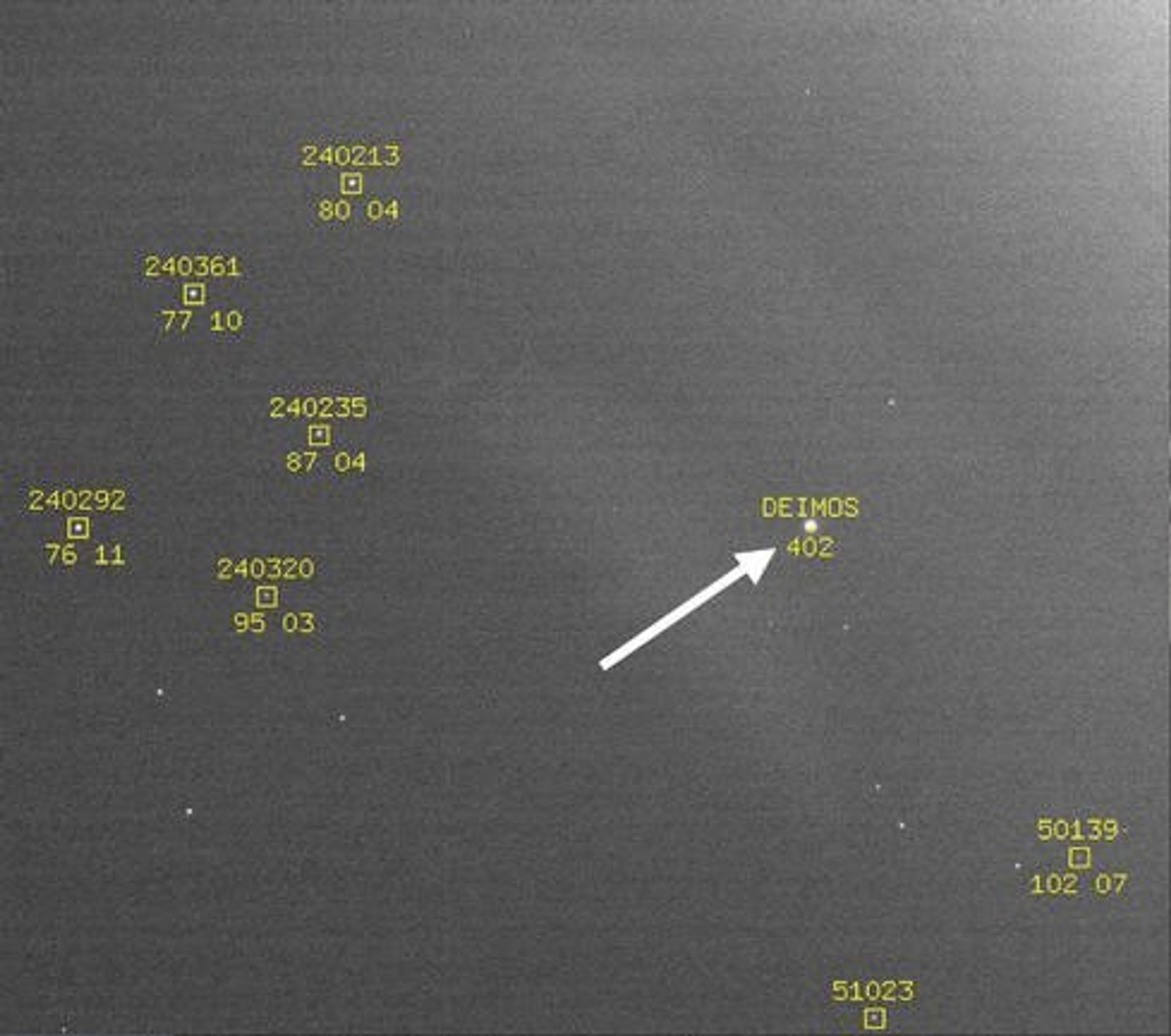
The Optical Navigation Camera was tested for improved navigation capability for future missions. Similar cameras on orbiters of the future will be able to serve as high-precision interplanetary "eyes" to guide incoming spacecraft as they near Mars.
From 30 days to 2 days prior to Mars Orbit Insertion, the spacecraft collected a series of images of Mars' moons Phobos and Deimos. By comparing the observed position of the moons to their predicted positions relative to the background stars, the mission team was able to accurately determine the position of the orbiter in relation to Mars.
While not needed by Mars Reconnaissance Orbiter to navigate to Mars, the data from this experiment demonstrated that the technique could be used by future spacecraft to ensure their accurate arrival. Accuracy will be important to future landers and rovers in need of extremely precise navigation to safely reach their landing sites.
Ka-band Telecommunications Experiment Package
While en route to the Red Planet, Mars Reconnaissance Orbiter demonstrated the use of a radio frequency called Ka-band Telecommunications Experiment Package (Ka-band) to enhance performance in communications using significantly less power.
Though the current standard in deep-space communication is a radio wave known as X-band, future spacecraft will incorporate radio systems utilizing the Ka-band of the radio spectrum. The Ka-band frequency is four times higher than X-band (32 gigahertz compared to 8 gigahertz), enabling transmission of much higher data rates. Mars Reconnaissance Orbiter carried a separate Ka-band radio to demonstrate this new capability for future missions.
Science Facility Experiments
Gravity Field Investigation Package
The Gravity Field Investigation studies the Doppler shift in the radio communications signal to determine the gravitational field of Mars. Scientists are using these observations to understand the subsurface structure of Mars on a scale of several hundred kilometers, as well as the rigidity of the planet as a whole.
The gravity field also helps scientists determine the density of the atmosphere and track seasonal changes in the location of carbon dioxide deposited on the surface.
Accelerometers
The Atmospheric Structure Investigation Accelerometers measured the density of atmospheric gasses at different altitudes during the spacecraft's repeated flights in and out of the Martian atmosphere. The measurements provided a new understanding of seasonal wind variations, the effects of dust storms, and the structure of the atmosphere.
Atmospheric Structure Investigation Accelerometers
During the aerobraking phase of the mission, data from the engineering accelerometer was used to determine the atmospheric density at the altitude of the spacecraft.
This information in turn provided information about coupling between the lower and upper atmosphere of Mars and about variations in seasonal winds and the effects of dust storms on atmospheric density.
